exploring ways for design to reframe and reshape agricultural landscapes.
Reframe
Animal Agriculture
Drainage
Nutrients
Agroecology
Commodities
Mapping
Aquaculture
Reshape
Climate Adaptation
Water Management
Tile Drains
Pond Design
Livestock Fencing
Information
Contact
©2024 Forbes Lipschitz
exploring ways for design to reframe and reshape agricultural landscapes.
Pictorial Cartography and Digital Printmaking
Experiments in Representing the Working Landscape
Publication
Chapter in Conceptual Landscapes: Critical Perspectives in the Earliest Stages of Design. Bussiere, S. (Ed.), London, New York: Routledge, In-press.
Abstract
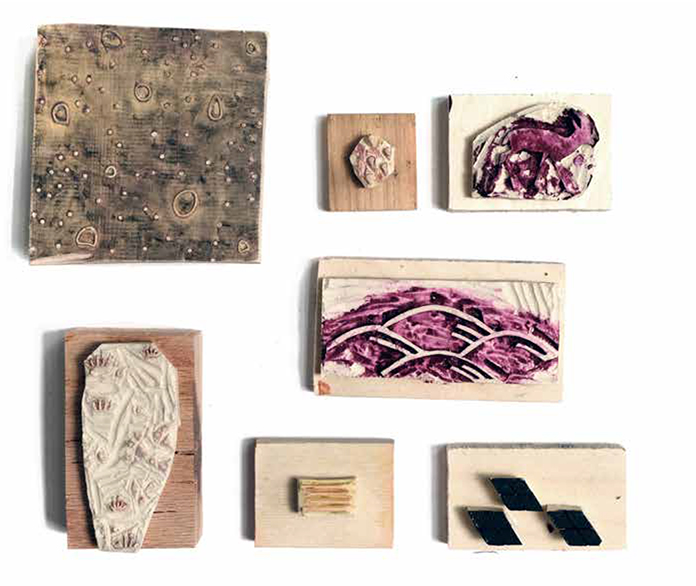
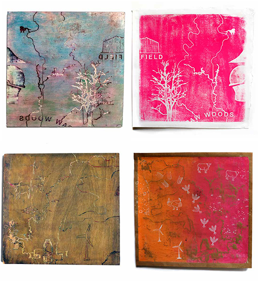
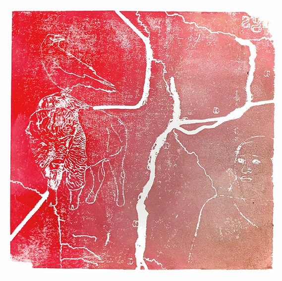
In the Spring of 2019, an upper level graduate and undergraduate design studio in the landscape architecture section of the Knowlton School at the Ohio State University experimented with new ways to represent the working landscape. The class worked collaboratively to re-envision the productive landscapes of the Great Plains in the face of climate change. The territorial scale of the project site necessarily required mapping as the primary design tool. Seeking to balance the scale of such a territorial design project with the cultural realities on the ground, the class experimented with pictorial cartography and relief printing. Pictorial cartography was chosen for its narrative potential. By combining map, image and text and manipulating scale, the pictorial map tells a visual story and captures a sense of place. Relief printing was chosen as a production technique because of its strong history in the Great Plains. In the 1930s, the Works Progress Administration commissioned thousands of artists to create posters and prints. Because materials and resources were scarce, the affordability of relief printmaking encouraged its widespread adoption in the region. The studio sought to revive both techniques as representational strategies particularly well suited to a contemporary territorial design project.